How long will it rain? Experts interpret the rainstorm in Henan, and the reason is here.
CCTV News:There are nearly 800 stations in Henan province with heavy rains of more than 100 mm, and the rainfall in Heping Mountain in Zhengzhou has exceeded the extreme value since the meteorological record. So why is this round of heavy rainfall in Henan so strong, and what is its cause? What’s the rainfall like today and tomorrow? What is the future direction and changing trend of rain belt? Let’s look at Zhu Dingzhen, chief meteorological service officer of the Public Meteorological Service Center of China Meteorological Administration.

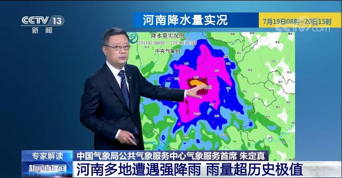
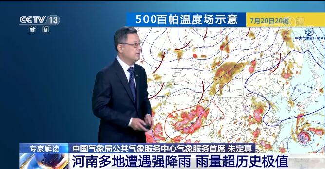
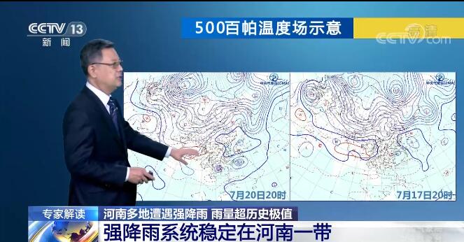
Zhu Dingzhen, Chief Meteorological Service Officer of Public Meteorological Service Center of China Meteorological Administration:The cloud image of Fengyun-4 satellite on the morning of 21st shows that the convective cloud cluster is developing very vigorously, that is to say, the precipitation in the area under this cloud cluster is very intense. Judging from the whole rainfall, it has been concentrated in Henan area in recent days, which has caused a very large cumulative rainfall. Judging from the whole circulation situation, precipitation happened in the concave part of the massive subtropical high in Henan, which is what we often call the shear convergence area. The emergence of this convergence zone caused the southerly warm and humid air flow, including the easterly air flow, to converge over Henan. This will produce heavy precipitation, and the system moves slowly, so it will "stare" at the sky above this area. From the weather situation on the 17th to the 20th, we can see that the position has basically not changed much. This caused the precipitation to be strong and lasting for a long time, coupled with the influence of local topography, which stimulated and induced stronger precipitation.
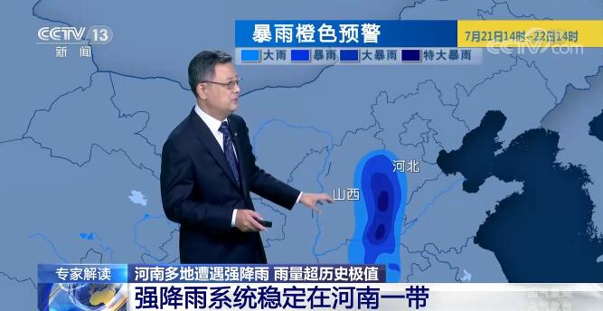
On the 21st, there will be heavy precipitation at the junction of Hebei, Henan and Shanxi provinces, but the circulation situation has developed to some extent. Because the circulation situation moves with the typhoon, the subtropical high has an eastward trend, so the whole water vapor channel and wind flow direction will be different from the circulation in previous days. As a result, from the 22nd, the whole rain will be weakened.